How do we interpret and generalise the results derived from analysing the relationships between spatial form and function?
Various models of spatial and functional patterns have been developed to interpret the results of analyses. They are used to predict socio-economic consequences that may result from interventions in the structure of space. Based on these, we can diagnose problems in buildings and cities, test development options, design the built environment and support decision making. Two general syntactic models are listed as below:
1. Space & movement model
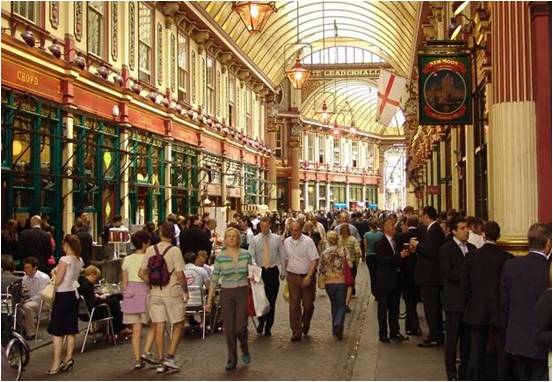
This can be used to describe and forecast pedestrian (or vehicle) movement in relation to spatial form in both buildings and cities. They allow us to explore how different layouts impact on movement. This model is built on the concepts of co-presence & co-awareness, natural movement, virtual community and movement economy (see figure A).
2. Space & activity model
This model is used to investigate the various activities occupying space. These could range from sitting and talking in an office room to the different uses of urban plots, to see how those activities are manifested in the spatial structuring of a building or a city.
At the building level, a wide range of building types such as healthcare, education, workplaces, retail, cultural buildings and transport station, can be studied. This model comprises the interrelated concepts of inequality genotype, strong & weak programs, and long & short models.
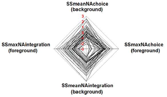
At the urban level, analysis focuses on a wide range of themes such as urban growth, accessibility profiles, pedestrian flow analysis and economic appraisal. Models are established on concepts such as pervasive centrality, spatial sustainability, foreground and background network, dual structure, and star modelling (see figure B).