How is the street network represented?
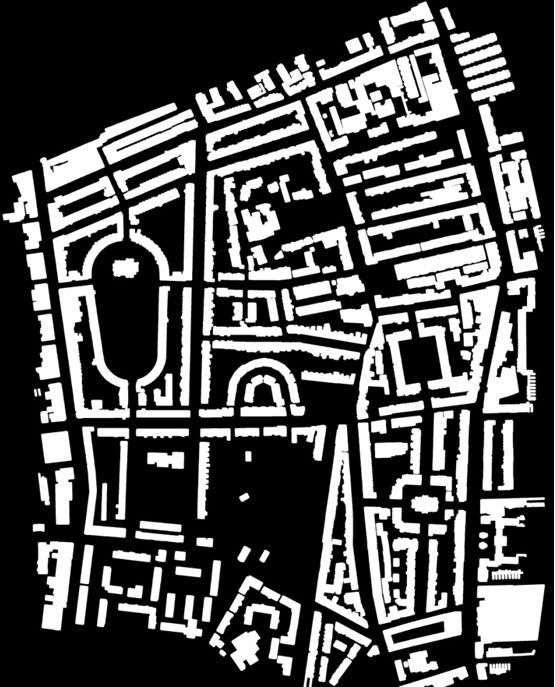
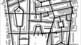
The street network is a continuous spatial network as shown by the figure-ground plan of Barnsbury in London (A). Space syntax seeks to provide an objective way of representing it. Many urban spaces are linear (e.g. streets, boulevards and alleys) and can be represented as axial lines and segments.
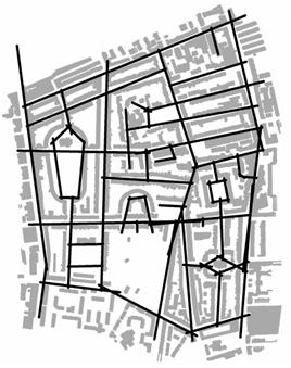
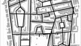
1 Axial map
An axial line is defined as the longest line representing the maximum axial extension of any point in a straight line. An axial map (B) is the least set of the axial lines which pass through each convex space (Hillier & Hanson, 1984: p91-92; Turner, A., Penn, A., & Hillier, B. ,2005: 432-7). The key principle of drawing an axial map is to minimize the number of lines and the angular change between any pairs of lines. The procedure of drawing axial map is elaborated here.
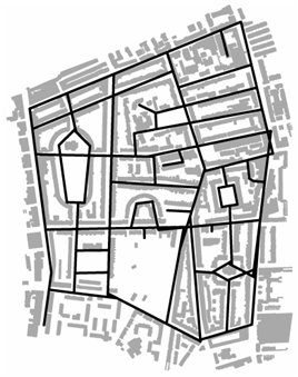
2 Segment map
Segment maps (C) enable us to represent the continuous open space in a finer scale. It can be generated by breaking axial lines into segments at the intersections of the axial lines. It can be generated from a road centre line map. Road centre line map is recommended to be simplified before it is converted into a road centre line segment map.
See the tutorial for further information.
3. Other methods
These include convex maps, visibility graphs, isovists, agents. For fuller details, please refer to the glossary.